The Armourdale Area Master Plan identifies actionable strategies that will strengthen the neighborhood core and will improve the quality of life for its residents.
UNIFIED GOVERNMENT OF WYANDOTTE COUNTY AND KANSAS CITY, KANSAS
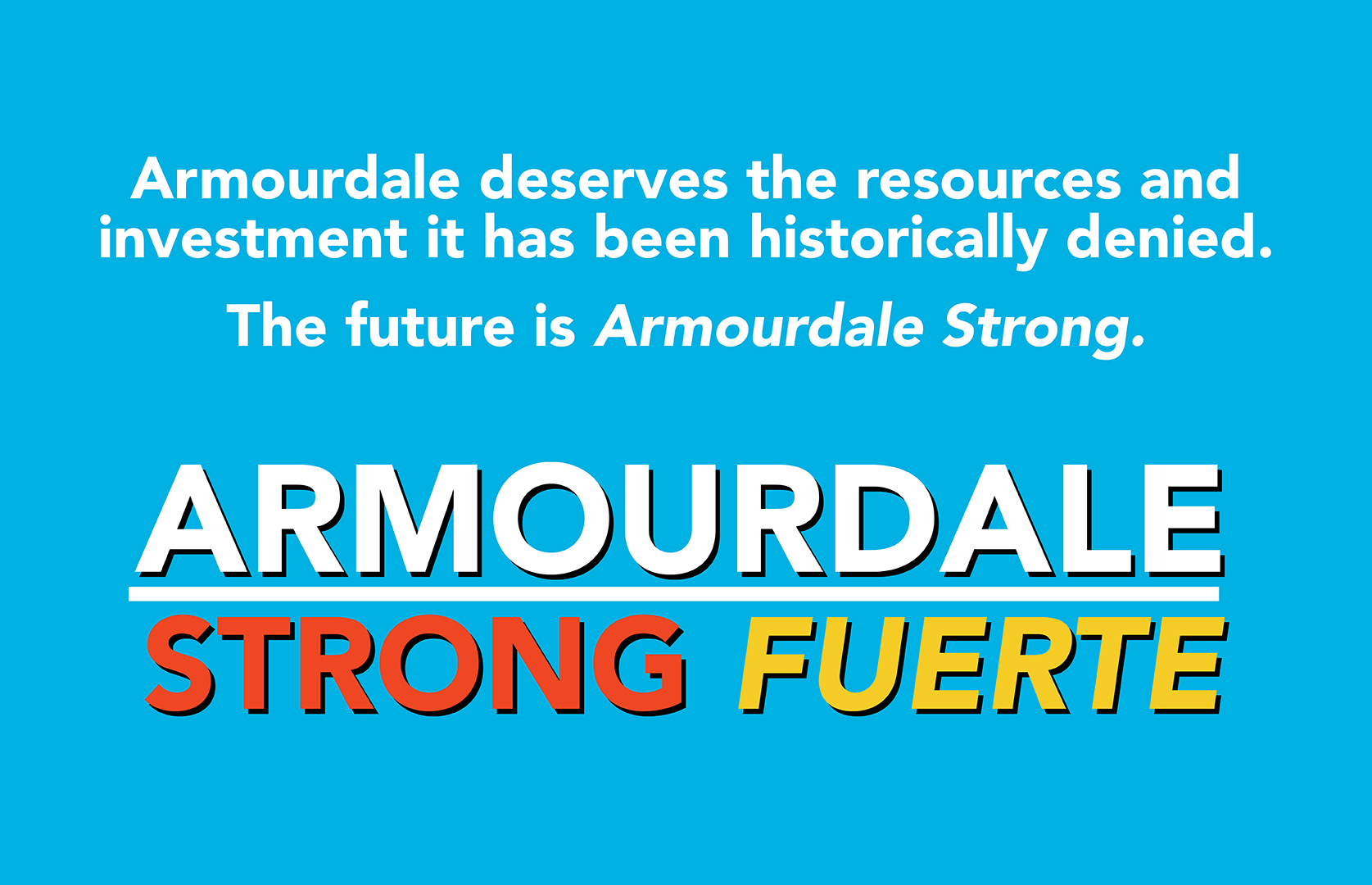
Armourdale Area Master Plan
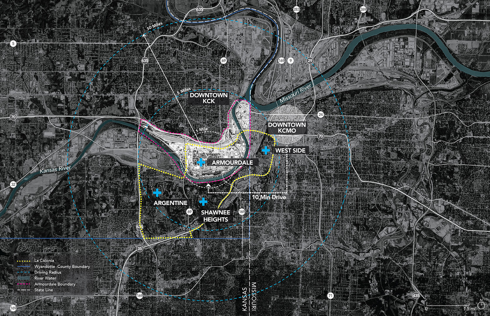
Armourdale District of Kansas City, KS
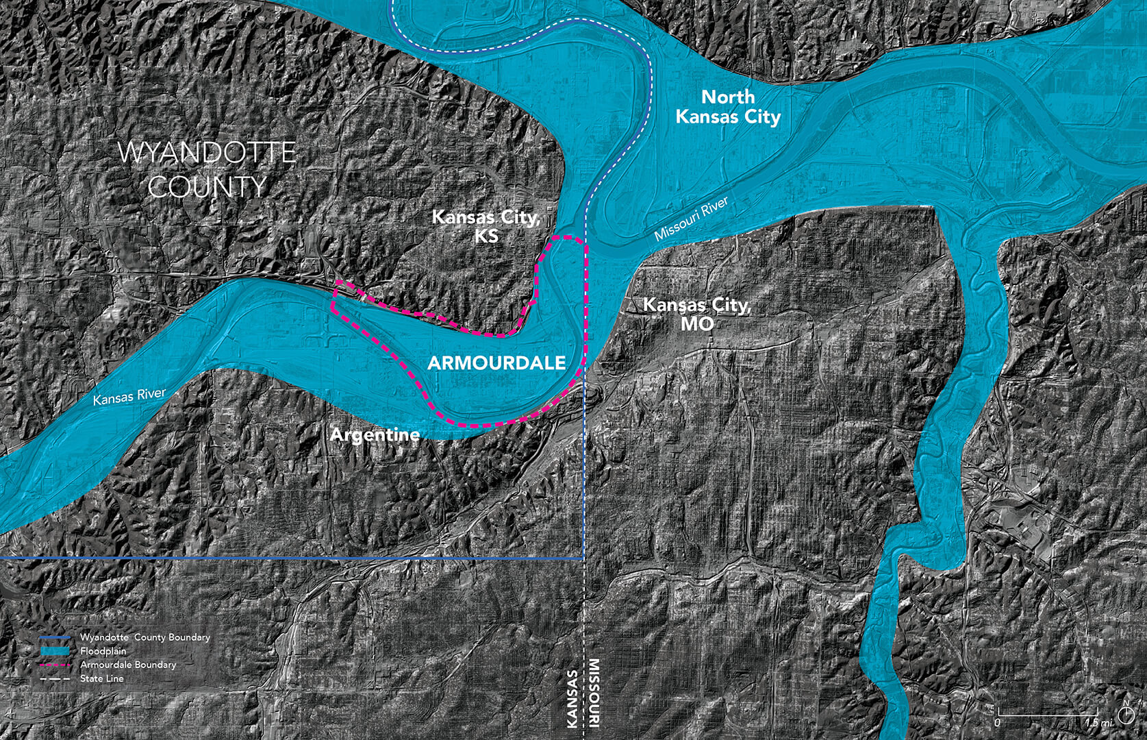
In 1879, the Armourdale district of Kansas City, Kansas was platted on approximately 2,000 acres of Kansas River floodplain. Armourdale was to become a new company town for workers of the nearby railroads, ice houses, and meat-packing plants. Despite Armourdale’s substantial population growth, increasing floods led to resident migration away from the community. The residents that remained endured regular flooding, declining living conditions, neglected infrastructure and minimal municipal services. In 2020, the Unified Government of Wyandotte County and Kansas City, Kansas commissioned the development of the first master plan for Armourdale since 1979. In order to identify community priorities and goals for the master plan, the planning team conducted an extensive community engagement effort that included: recruiting, hiring and training neighborhood residents; initiating regular meetings with community-based organizations, local experts and a stakeholder steering committee; and hosting several community events and workshops.
Click here to view the full Master Plan
COLLABORATORS
Community Engagement + Master Planning: Borderless Studio
Community Engagement + Master Planning: MVRDV
SERVICES
Framework Planning
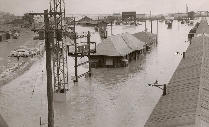
1951 Flood
In 1951, the most extreme flood event in Kansas City’s history devastated Armourdale. Following the flood, significant levee and flood control projects were implemented primarily to protect Armourdale’s high-value railroad and industrial businesses.
Photo Courtesy of Wyandotte County Museum
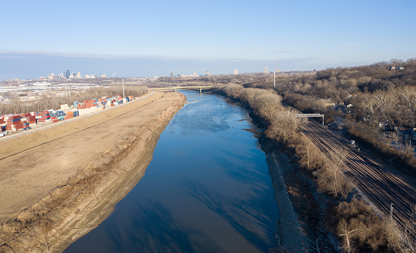
Kansas River Levee
While flood control measures have protected Armourdale’s neighborhood core for the last 70 years, they have created an island-like condition for the community. As a result, Armourdale has endured decades of neglect and disinvestment.
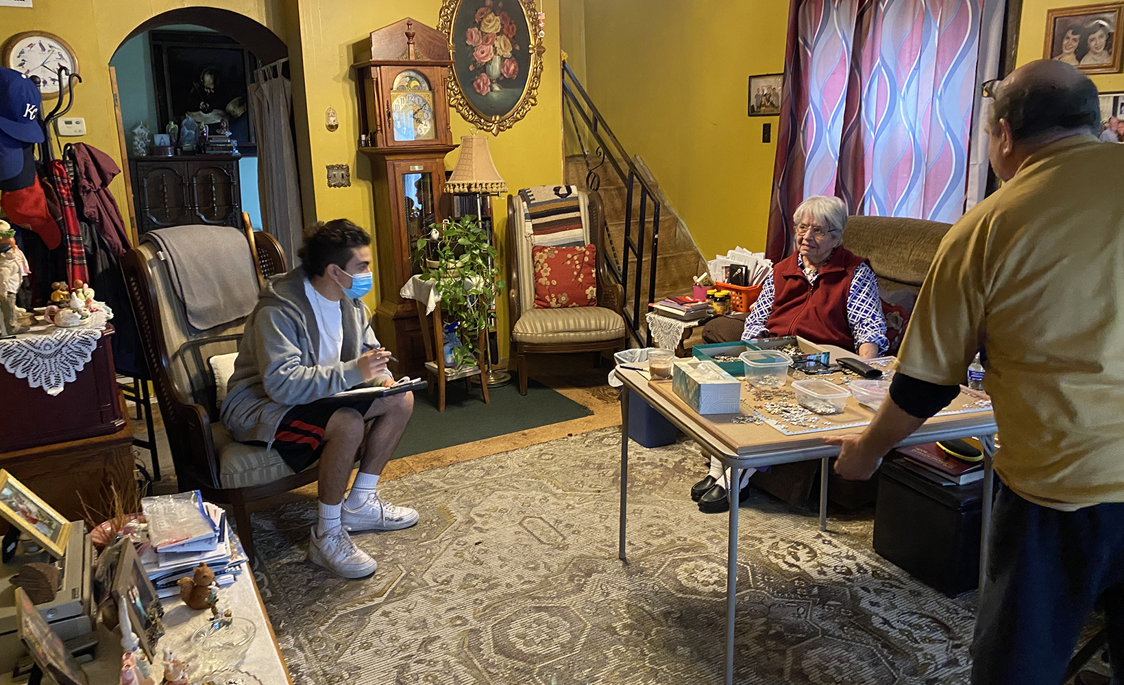
Community Outreach
The community outreach approach was rooted in active engagement with community groups, public audiences, and stakeholders through ongoing conversations and interventions. To ground the planning effort in real community needs, the outreach approach relied on three (3) core strategies: an Outreach Team, constant dialogue with community experts, and continuous engagement.
Master Plan Goals
The goals of the Master Plan are to protect the existing residential fabric of Armourdale, improve the quality of life for Armourdale residents, and open up more opportunities for people to live in Armourdale.
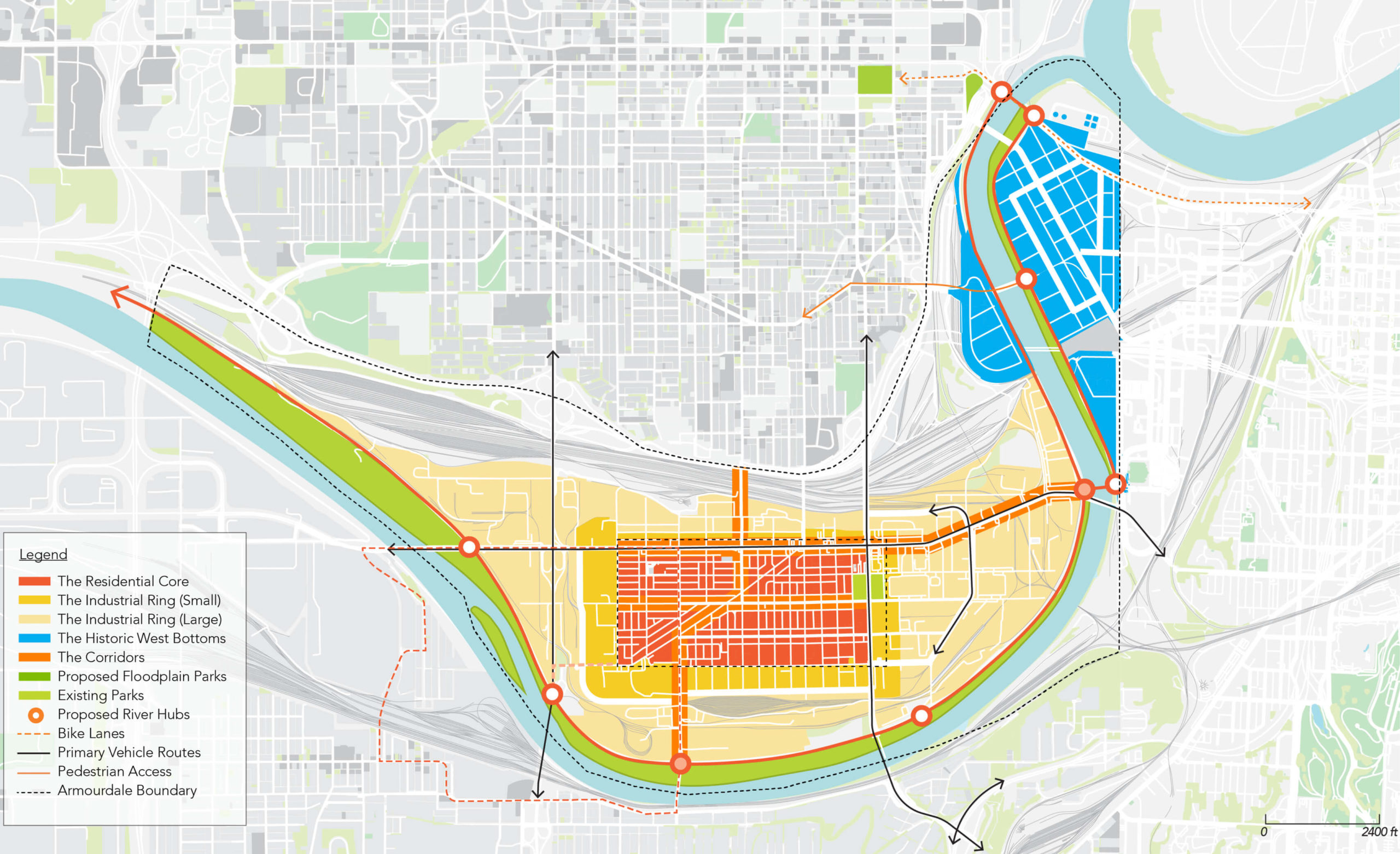
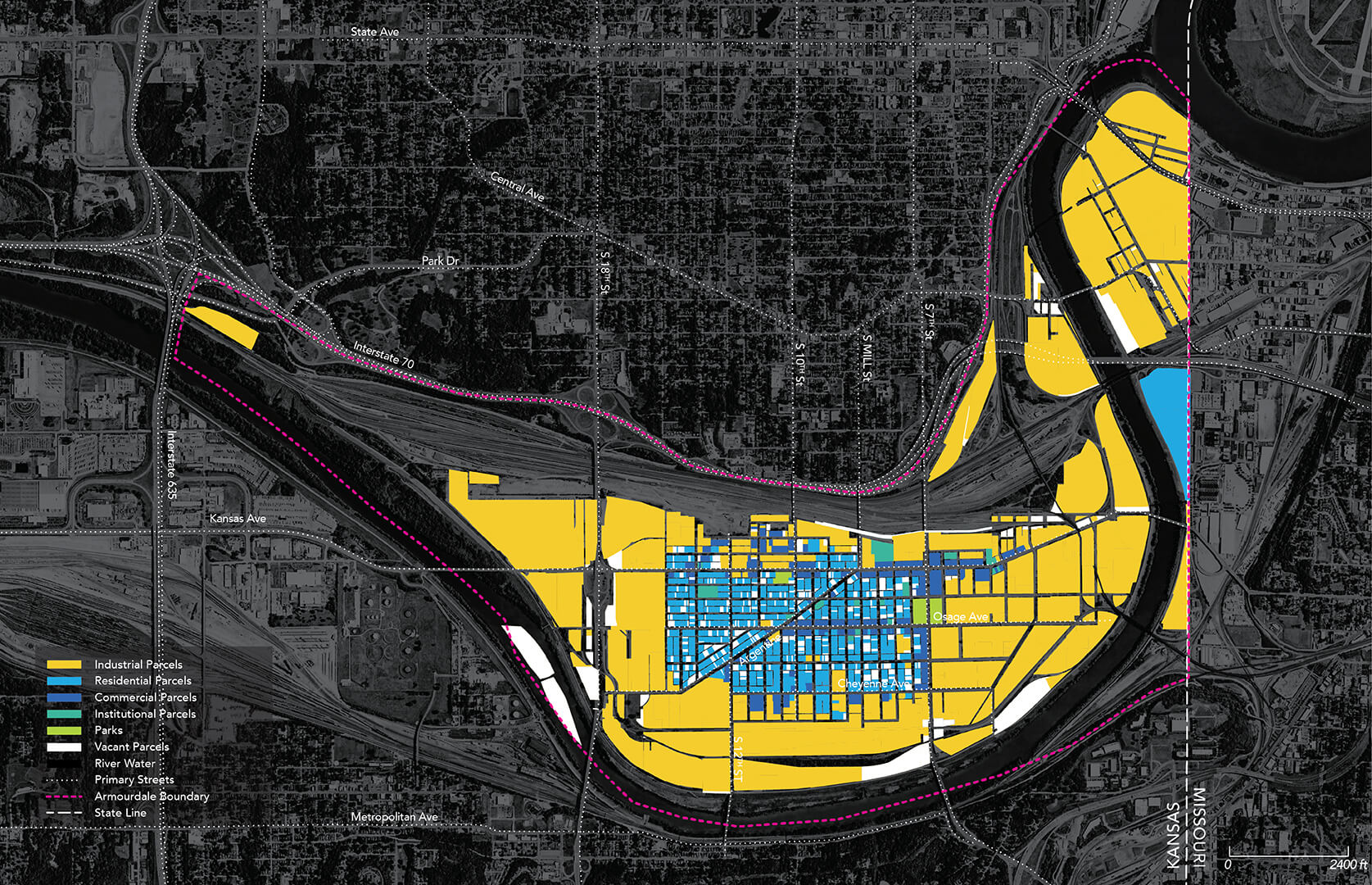
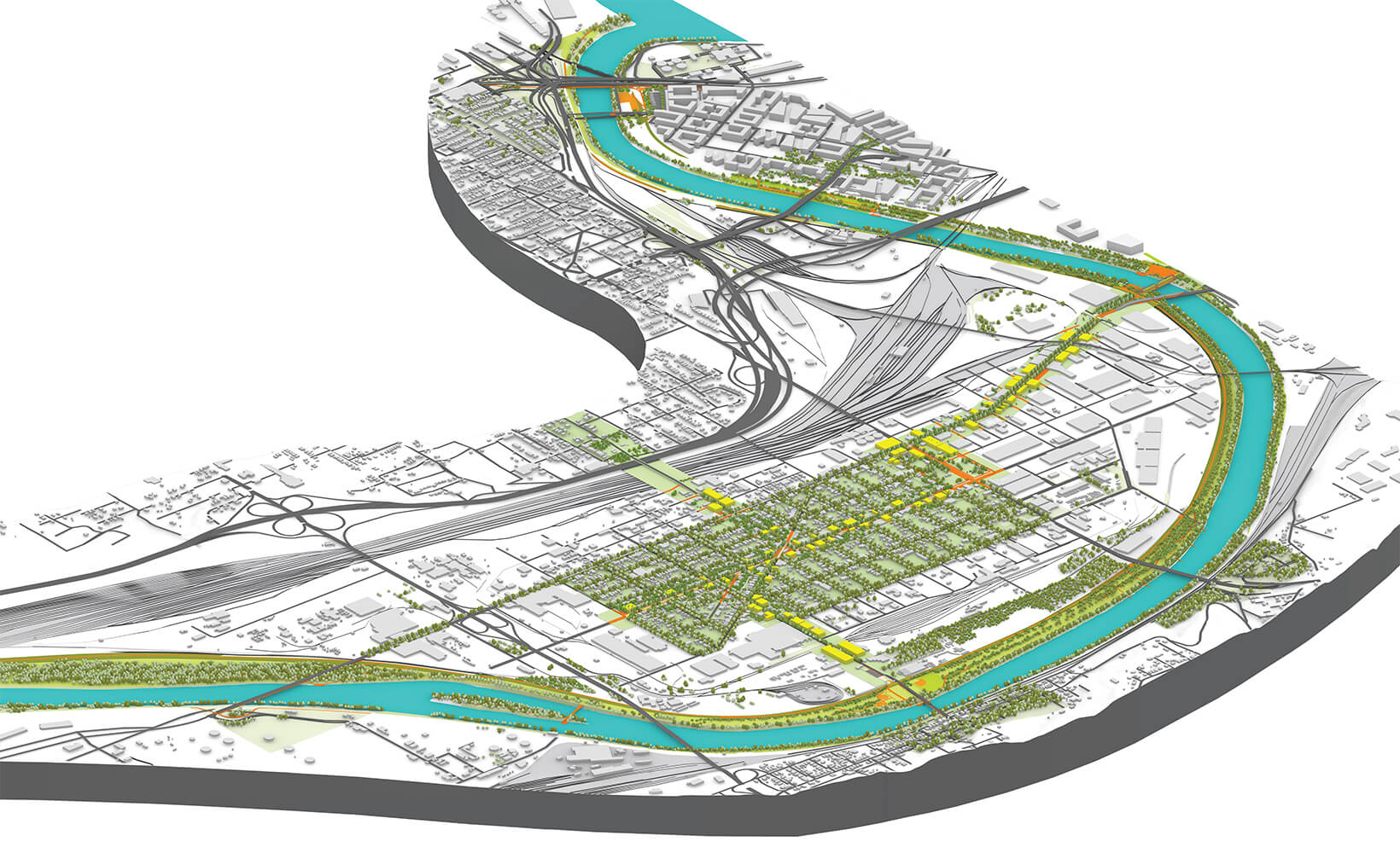
Focus Areas + Strategies
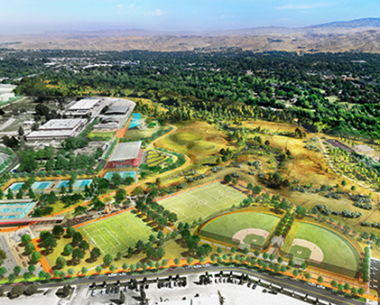
The strategies and actions outlined in the Armourdale Area Master Plan are centered upon five (5) primary focus areas: The Neighborhood Core, The Commercial Corridors, The Industrial Ring, The Kansas River, and The Historic West Bottoms.
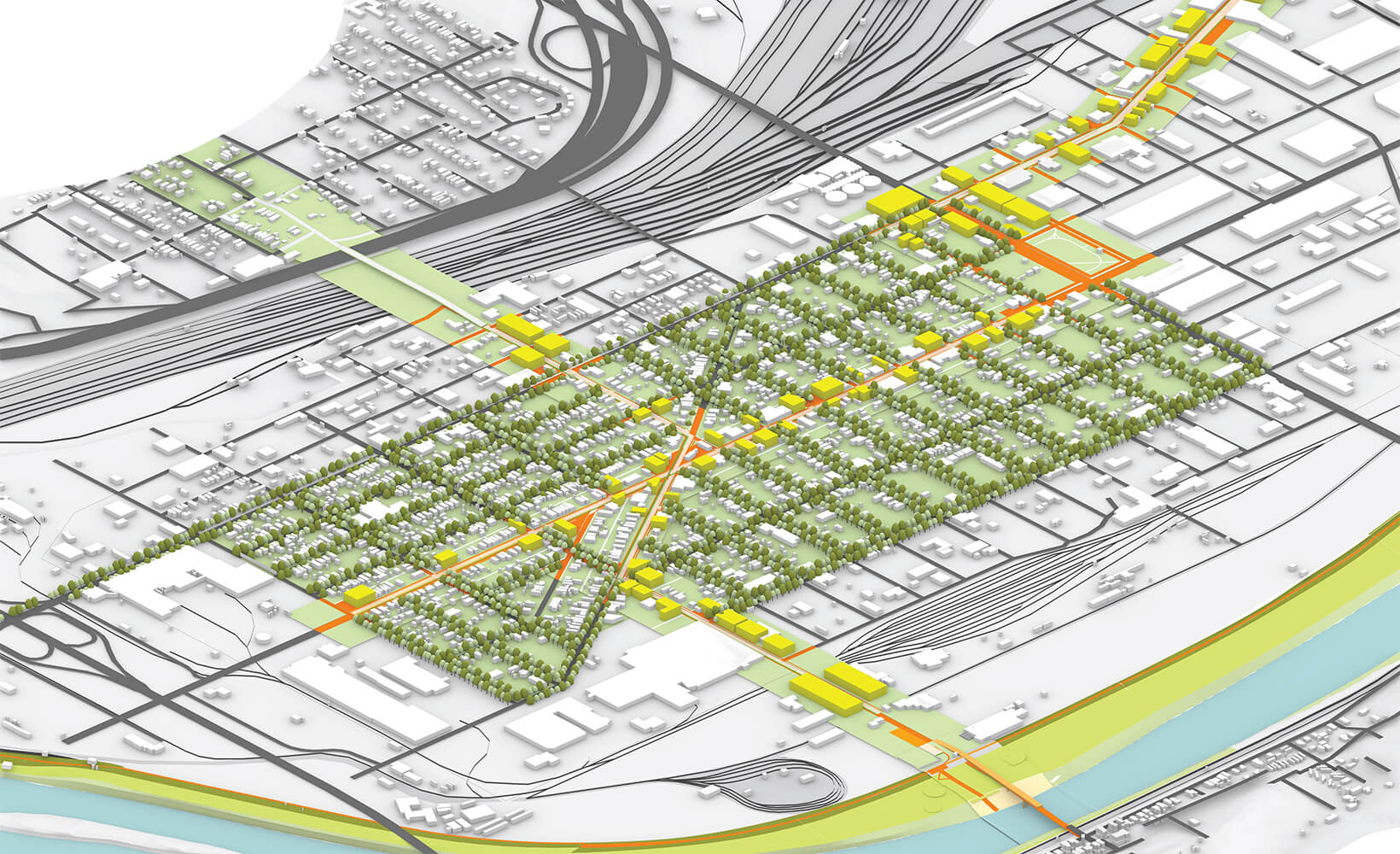
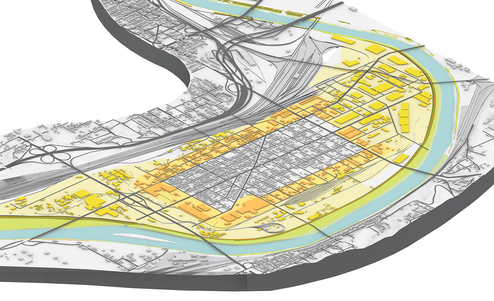
Neighborhood Core
The neighborhood core of Armourdale has been underserved and under-represented for decades, despite the fact that it has persisted even after years of flooding, disinvestment, urban renewal, and displacement. The Armourdale’s resilience should be celebrated and the Master Plan recommendations should be understood as directing resources to serving the community.
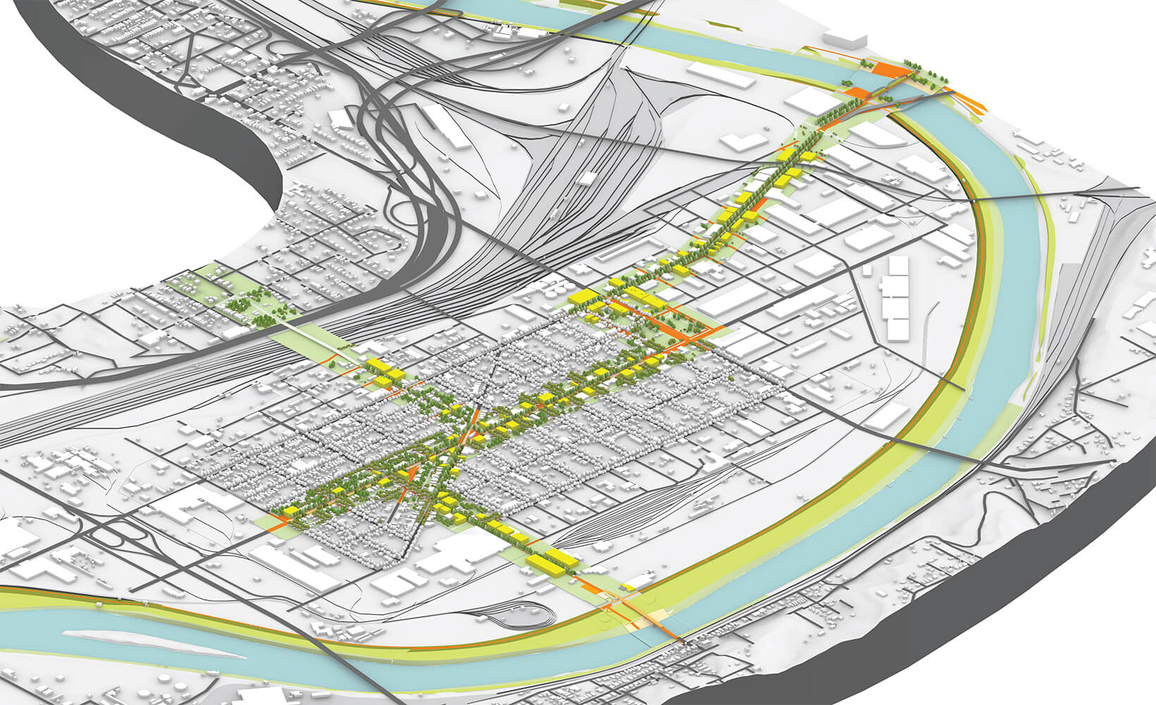
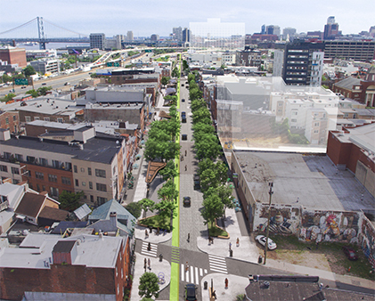
Commercial Corridors
The goal for the investment in the commercial corridors is to enhance business opportunities along each corridor, create dense development that is walkable and scaled appropriately to the neighborhood, and increase the amount, quality, and performance of public space along each corridor.
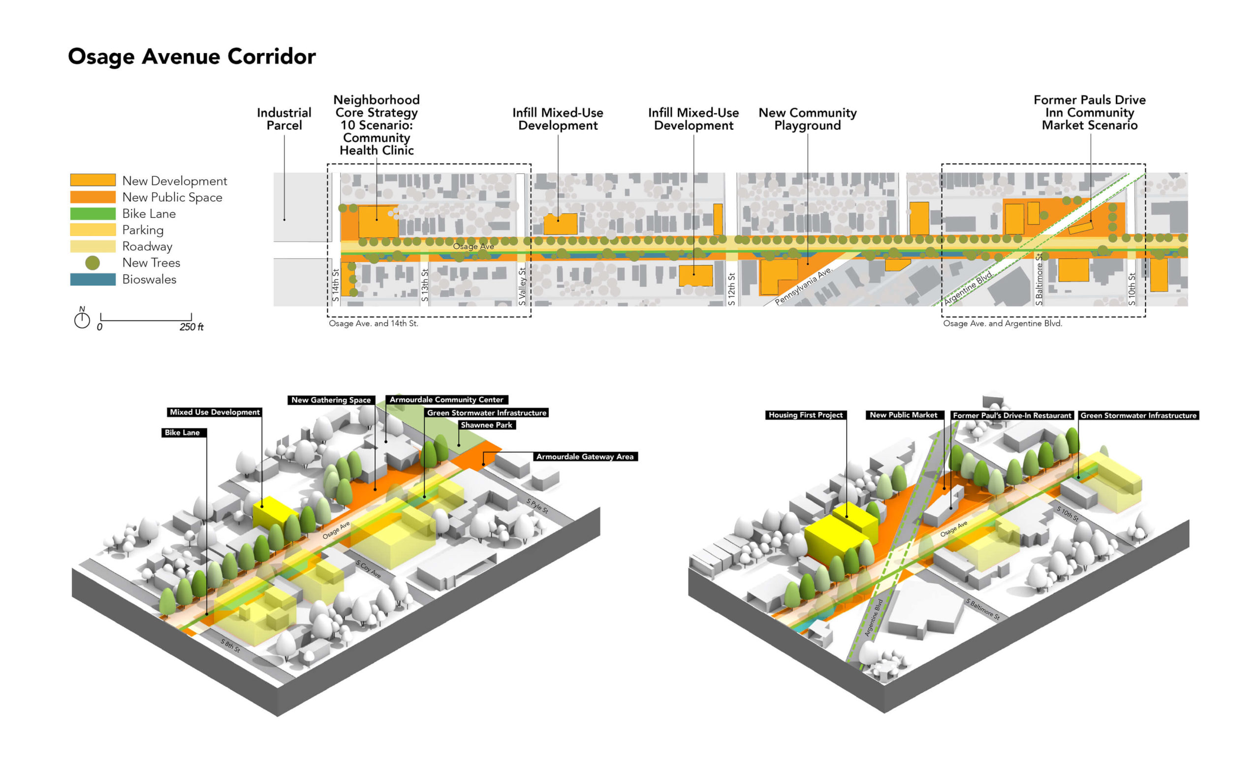
Commercial Corridors
The Master Plan outlines five new policies and five actionable strategies for the Commercial Corridors of Armourdale, including (partial list): emphasizing Green Stormwater Infrastructure; reducing traffic lane width; including protected bike lanes; eliminating building setbacks; and supporting green alleys.
Industrial Ring
Armourdale has always been home to both industry and the industry workers. The Master Plan’s goals for the Industrial Ring are first and foremost to help the Industrial Ring become a net contributor to Armourdale’s economic, environmental and social health.
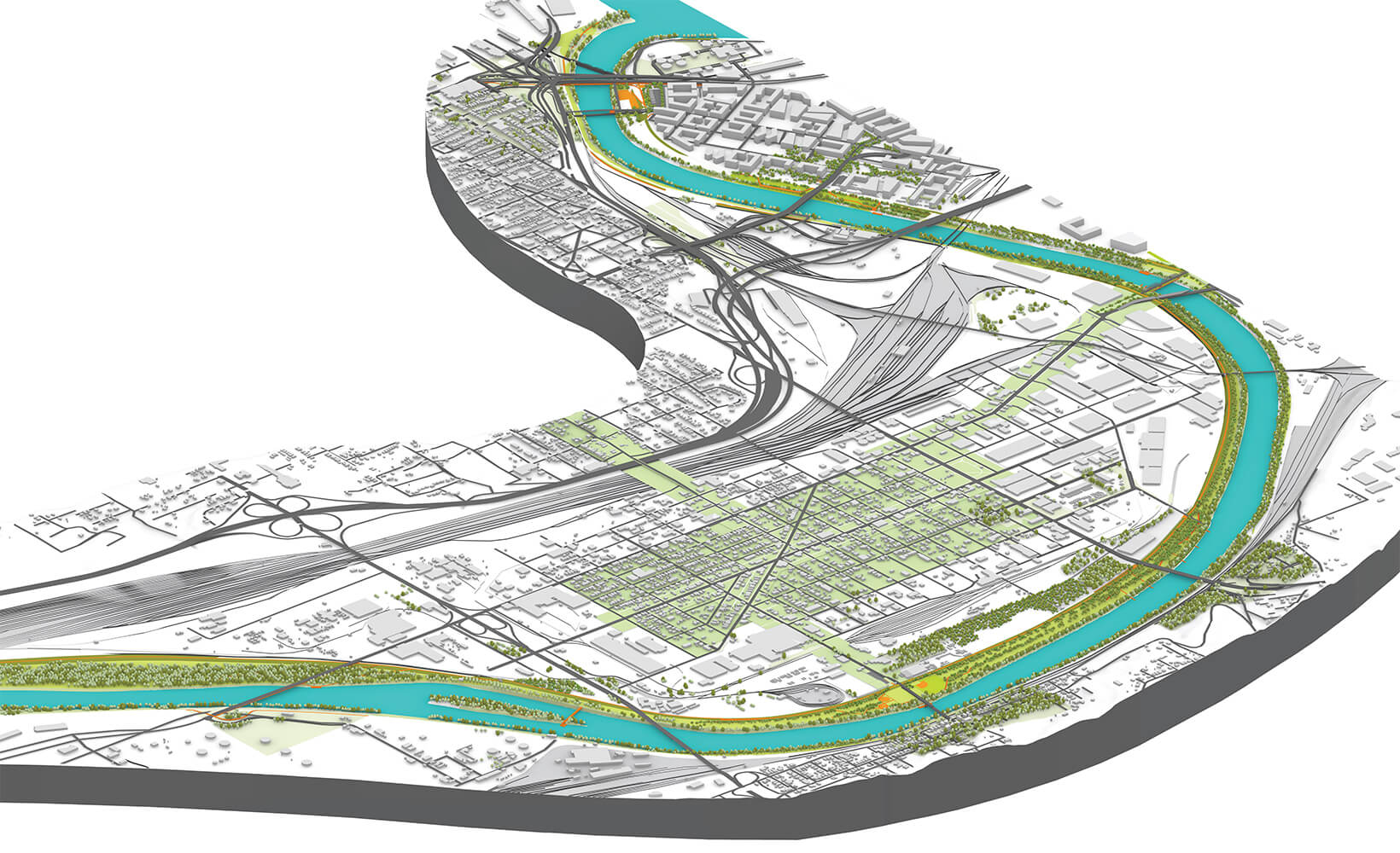
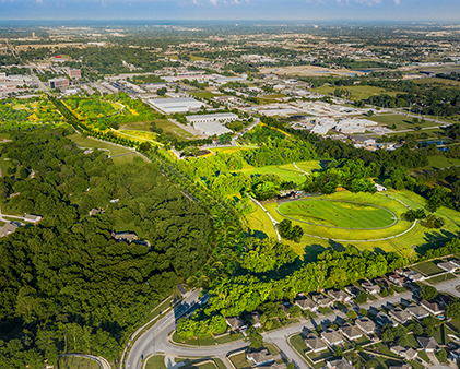
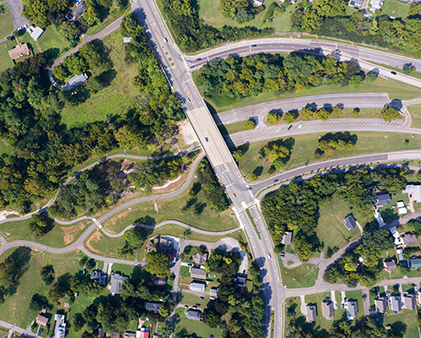
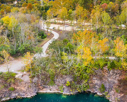
Kansas River
The Kansas River has historically been ignored as an Armourdale asset and as an important part of the local ecology. The Master Plan aims to increase access to the Kansas River so it may become an everyday community resource.
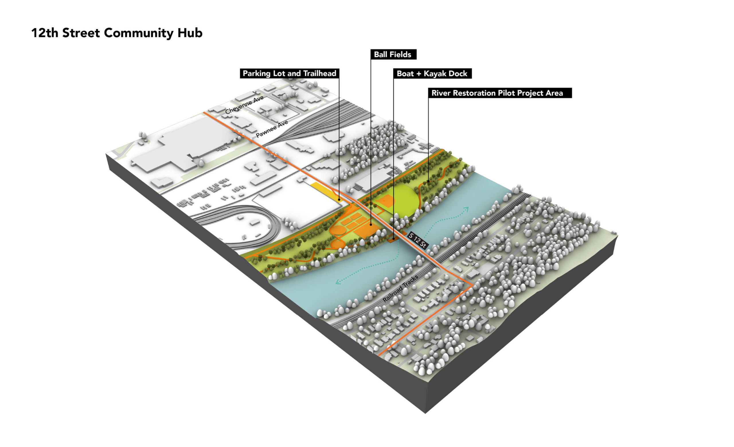
Kansas River
The river and its floodplain should offer parks, fishing spots, hiking trails, recreational fields, and other assets. The Master Plan calls for investment in several key sites — Community Hubs — that feature robust public facilities with parking, water access, trail access, and other amenities.
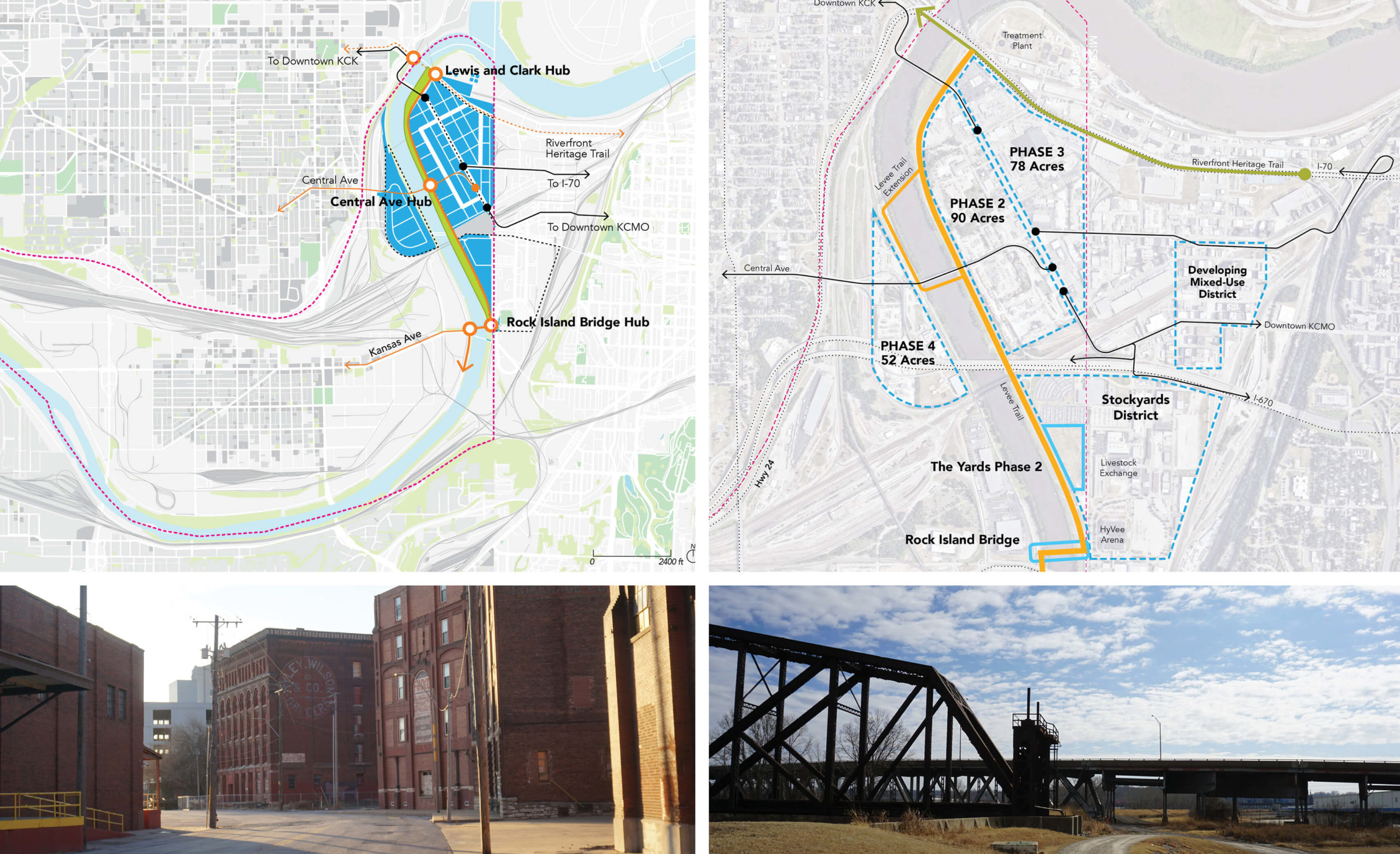
West Bottoms
The West Bottoms encompasses the historic stockyards area east of the river. Industrial in character, it is adjacent to two developing mixed-use districts. This Master Plan proposes redeveloping the West Bottoms as a mixed-use district centered on the restored Kansas River.